

Photo courtesy of Taylor Black
Several severe thunderstorms passed through Dallas, Guthrie, and Adair counties Monday afternoon and evening, which activated the Raccoon Valley Radio Severe Weather Action Team.
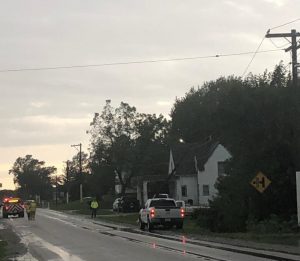
The initial warning was issued by the National Weather Service for Adair and Guthrie counties at around 3:45 p.m., heading northeast, and eventually encompassing Dallas County. The second warning was issued at 5:25pm for western Guthrie County and the final warning was issued at 5:54pm for eastern Guthrie County and Dallas County. The final warning expired at 6:30pm. The primary hazards were straight-line wind gusts, radar-indicated nickle-sized hail, heavy rainfall, and lightning. Guthrie and Adair County Emergency Management Coordinator Bob Kempf reported that 4-6-inch tree limbs were down in Menlo and a bent power pole on White Pole Road in Stuart. Also, Dallas County Emergency Management Coordinator A.J. Seely reported a 12-inch tree limb down in Minburn, small limbs down in Redfield, and pea-sized hail in Perry.
Ten members of the Severe Weather Action Team,Weatherology meteorologists, as well as Seely and Kempf took part in the live coverage of the storm. There is still a slight threat of severe storms the rest of the night, and a tornado watch in effect for all of central Iowa until 10 p.m. The one to count on for severe weather coverage is the Raccoon Valley Radio Network.