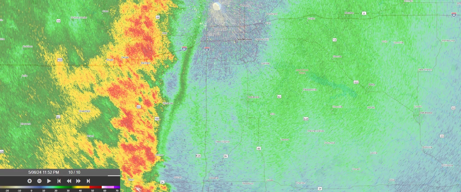
Raccoon Valley Radio’s Severe Weather Action Team responded to several thunderstorms, as well as a tornado warning Monday evening
The National Weather Service issued a tornado warning for northwestern Greene County at approximately 10:26pm as the Severe Weather Action Team was already broadcasting at about 9:40pm thunderstorm warnings in western Greene County and northeastern Guthrie County.
Greene County Sheriff Jack Williams reported pea to dime size hail in Ralston, and the storm sirens were activated in Churdan, as the path of the storm capable of producing a tornado was headed toward that town. Williams said the Lanesboro Fire Department reported cloud rotation at 110th Street and D Avenue with storm spotters being deployed in Churdan, Scranton, and Jefferson. Wind gusts were moving northeast at about 60 mph.
Additionally, Guthrie County Emergency Management Deputy Coordinator Jeremy Cooper reported a couple of large pockets of hail near the City of Adair, with power outages countywide in Audubon County and reports of nickel sized hail in Greenfield to the northern edge of the Guthrie/Greene County line to Rockwell City. Emergency Manager Bob Kempf added that rain began falling at 10:14pm on Highway 44 and the Guthrie/Audubon County line with heavy rain in Panora.
Western Dallas County was also issued a severe thunderstorm warning at 10:09pm with storms located along a line extending from four miles southwest of Dedham to Anita to five miles south of Corning, moving northeast at 40 mph. The National Weather Service expired the thunderstorm warning for Dallas and Guthrie counties at 10:50pm followed by the expiration of the thunderstorm and tornado warning of Greene County at 11:13pm.
Five RVR employees were a part of the Severe Weather Action Team coverage as well as Weatherology, the Greene County Sheriff’s Office, Adair and Guthrie County Emergency Management, and the Dallas County Emergency Management assisted. Raccoon Valley Radio’s Severe Weather Action Team provides live coverage until the storms move out of the coverage area or drop below severe levels.

