
Updated information has been released by the National Weather Service about the rest of today’s severe weather potential.
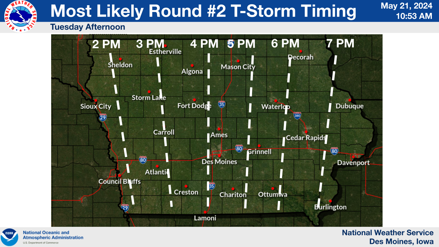
The National Weather Service is estimating the timing for the strongest thunderstorms to happen in Greene, Guthrie and Dallas Counties is between 3 and 5pm. The risk level remains at moderate to the coverage area, which is four out of five categories. 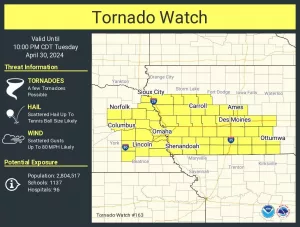
Additionally, the National Weather Service also has the coverage area under a flood watch until 7pm tonight and a river flood watch until Saturday. A tornado watch has also been issued by the National Weather Service for most of the state until 9pm. National Weather Service officials have tagged the tornado watch as a “particularly dangerous situation” with the likelihood of intense and devastating severe weather. Hazards could include winds of 70-90 miles per hour and up to softball-sized hail, along with several tornadoes.
Raccoon Valley Radio’s Severe Weather Action Team will interrupt regular programming with live coverage should there be a severe thunderstorm or tornado warning that is issued for Greene, Dallas and Guthrie Counties.