
Image courtesy of NWS
With the blizzard that the state of Iowa took on this past weekend, even more snow is slated to come.
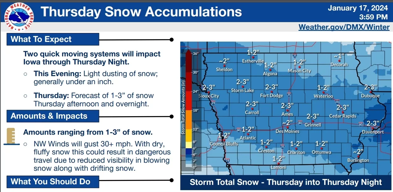
National Weather Service Lead Meteorologist Brooke Hagenhoff is estimating between 2-3 inches of snowfall from this afternoon into the overnight, which is once again going to pose some issues on the roadways.
“Now this is going to be very light, very dry, very fluffy snow (and it’s) highly susceptible to blowing, and we’ve got about a foot of snow already on the ground, which means this is going to slide around a lot on top of that.”
There is also going to be high winds of around 25 miles per hour tonight. Hagenhoff points out that after the snow tapers off early Friday morning, temperatures will also begin to drop off, with wind chills in the -20 to -30 degrees and that will hang on through Saturday.